The seaweed, explained
What is sargassum?
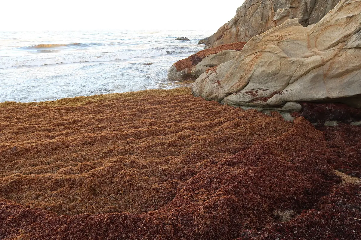
Sargassum is a floating brown seaweed. Out at sea it is good news: fish and sea turtles shelter in it. Piled on your beach, it is brown water, a rotten-egg smell as it decays, and sometimes a shoreline you cannot comfortably swim from. Here is what it is, why the Caribbean suddenly gets so much of it, why 2026 has been a record year, and what all of that means for your trip.
Out at sea, it belongs there
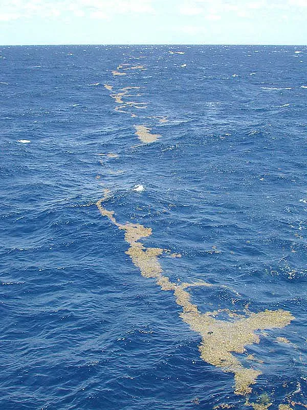
Sargassum normally lives in the open Atlantic; a whole region, the Sargasso Sea, is named for it. Floating offshore it is an ecosystem: NOAA describes it as food, shelter, and breeding ground for fish, crabs, and sea turtles. The seaweed is not the villain; the problem starts when huge rafts of it wash ashore where people want to swim. NOAA Ocean Service source.
What changed: the Great Atlantic Sargassum Belt
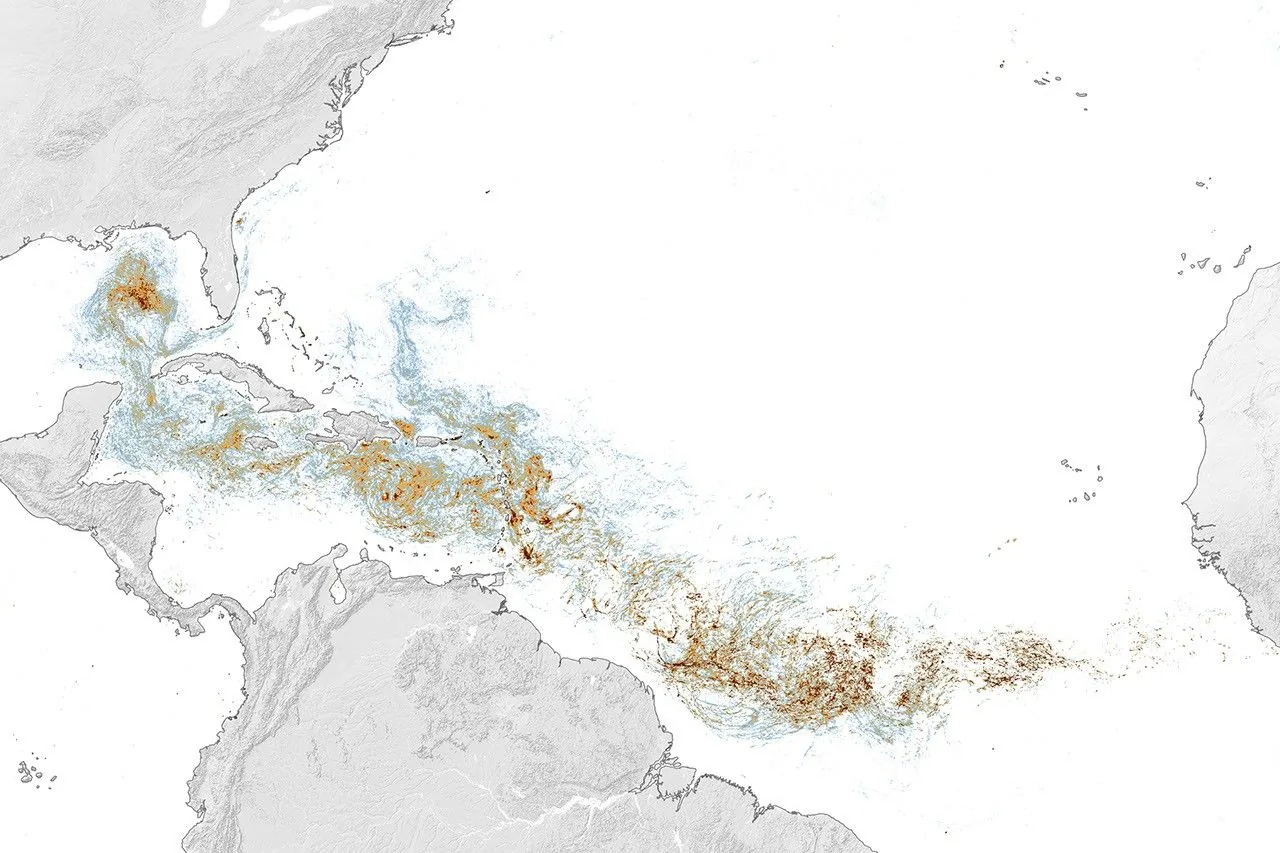
Around 2011, something shifted. A new band of sargassum began blooming each year across the tropical Atlantic, stretching from West Africa toward the Americas: scientists call it the Great Atlantic Sargassum Belt. It has grown enormously since it appeared; NASA reports the total amount in the Atlantic has more than doubled every five years. Each spring and summer, winds and currents carry portions of the belt west into the Caribbean, the Gulf, and Florida, and heavy beaching years have become the norm rather than the exception. NASA Earth Observatory.
2026 has been a record year
This year the belt came in early and huge. Satellite estimates reported by the University of South Florida's monitoring team put the Atlantic total at 9.5 million metric tons in January, 13.6 million in February, and 19.1 million by the end of March, records for each of those months. April then set records in nearly every region tracked, and record amounts washed ashore from the eastern Caribbean to Mexico and Florida through the spring and summer. By June, the eastern Caribbean held about 9 million metric tons and the Gulf about 5 million, nearly double the Gulf's previous record. WUSF, WGCU, ABC News, NASA Earth Observatory.
A record belt does not mean every beach was buried. It means the odds went up everywhere, and the gap widened between coasts that catch the seaweed and coasts that do not. That gap is the whole reason this atlas exists. You can see any month for yourself on the historical satellite maps on each destination page.
Why your beach gets it (or does not)
Seaweed drifts in on wind and current, and it mostly lands on coasts that face the open Atlantic. Which beach it lands on, and when, is genuinely hard to predict even a week out, which is why this atlas leans on current data and cameras instead of promises. NOAA CoastWatch FAQ.
The smell, and who should take it seriously
Fresh seaweed on the sand is mostly a nuisance. Once it sits and decays, it releases hydrogen sulfide (the rotten-egg smell) and ammonia. For most people that means an unpleasant walk; travelers with asthma or other respiratory conditions should follow local health guidance and keep their distance if the odor causes symptoms. US EPA health overview.
What satellites can and cannot see
The satellite data behind our risk levels spots floating seaweed offshore. It can also mistake other floating algae for sargassum, and it loses visibility under clouds and sun glare. What it can never do is inspect the sand in front of your hotel this morning; that is what beach cams and a same-day photo from the property are for. AFAI metadata.
What this means for planning a trip
editorial Three rules of thumb, each with its own full guide:
- Season. The seaweed typically ramps up through spring and peaks May through August, so a March or April spring break usually lands before the worst of it. But record years like 2026 start early, so check conditions as your dates approach instead of trusting the calendar. Full guide: When is sargassum season?
- Hardest hit. East-facing, windward coasts catch the most: the Riviera Maya (Cancún, Playa del Carmen, Tulum), eastern Barbados, and the Atlantic sides of the Lesser Antilles such as Martinique and Guadeloupe. Their destination pages show what that looks like month by month.
- Usually spared. West-facing, leeward coasts and islands out of the belt's main path see far less: Aruba, Curaçao, Negril in Jamaica, and the sheltered sides of most islands. Conditions can genuinely differ beach to beach on the same island, which is why we track coasts rather than countries. Full guide: Where beaches stay clearer